San Blas
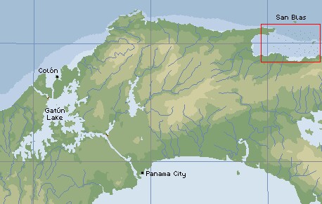
The San Blas are 100 miles east of
the Panama Canal entrance |
Language: Mostly Kuna, but more Spanish is spoken now than we saw in 1988.
Population: About 20,000 on the islands, and more inland.
Money: The good old US dollar, amazingly enough.
Landscape: Coral-reefed, sandy islands, covered in coconut palms and low shrubs.
The Panamanian coast here is lined with mangroves, sicropia trees, bananas, and kapok trees.
Visited: We spent from February 15-27, 2003 in the San Blas
islands (and could have easily spent longer).
|
Cruisers: We are now publishing
Downloadable Track Files in OpenCPN (.gpx) format and in MaxSea (.ptf) format (not all tracks are available in all formats yet - we're
still working on it and they take time). You can download the track files either by clicking on
the links in the tables below, or by clicking on the track in the Google Map below the table. The
MaxSea files are in native format but the OpenCPN files are zipped so they download faster, and they need
unzipping after they've been downloaded (which most operating systems do natively). If 2 files are shown, the
smaller one has been edited to remove redundant points from straight
tracks. This improves the speed of the download as well as performance once the file is loaded.
Sometimes MaxSea Track files are separated from the Mark (chart notations) files.
Download instructions are provided if you need them.
These files are provided free and we are actively soliciting cruisers to send us your track
files so we can post them for others to download. If you would like to to participate, please
email us your track files (as attachments to our HackingFamily
account, not our Winlink acct) along with your boat name and draft. If you include your
website and boat details, we'll link back to you from our
Cruising Links page.
Disclaimer: While we always try to provide useful information, we can take no responsibility
for its accuracy or usefulness. Prudent mariners will always navigate using all means at
their disposal, and will not rely solely on electronic navigation.
|
Panama and San Blas Tracks
| Boat |
Draft |
Year |
Comments |
MaxSea |
OpenCPN |
| Taniwani |
6.6' (2m) |
2005 |
Slightly different from our trip |
15 KB |
7 KB |
Note that Taniwani's San Blas tracks were originally
made using GPS offsets to make the positions match the charts. As of 2011, the
CM93v2 charts were still incorrectly placed for San Blas.
We believe that we have successfully removed those offsets
and that these track files are now corrected for WGS84. However, like all electronic
aids to navigation, we recommend that you not depend solely on these tracks for your
navigation through the San Blas Archipelago. |
See
Taniwani's Panama & San Blas Islands Tracks in a larger map. |
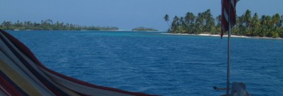
Looking past our hammock as we
sail through the beautiful San Blas islands |
History: Legend
has it that the Kuna Indians came down from the Panamanian mountains to the
coast to escape the ravages of malaria. They brought with them their canoes
(which they had used on the rivers) and their language which continues through
today. In 1925, when the San Blas were totally governed by the Panamanian
government, there was a large Kuna uprising that ended with the deaths of
22 Panamanian policemen and 20 Kunas. After the uprising, the government granted
the Kunas the right of self-government, and they have controlled the 2360-km2
ever since. Today, they even have the right to vote in Panamanian
elections and two representatives in the Panamanian legislature.
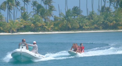
Our trip around the anchorage had
all three of us screaming like crazy. |
(Amanda age 13) I must
say, seeing the San Blas after four long days of sailing
was a blessing. Green islands, white sand, and turquoise water. What more could I ask
for? Well, I could think of some, but I'm not going to go there. Let's just say it was
wonderful.
Before we got
there, Mom had said that the Kunas, the San Blas locals, lived on coconuts. I'm
not sure if that's living from eating them or selling them, but I think they
could do either or both at the same time. Those islands are jam-packed with
coconut palms. It was obvious which islands people were living on because they
had nicely cut out all the scrubby underbrush and big bushes, making it a lot
easier to find coconuts that fell. The islands that weren't inhabited were almost
impossible to walk through. It makes me wonder whether the Kunas choose the
islands they choose because those ones are thinner, or so few of them because
they are so hard to clear.
In the San Blas, we met up with our friends on Vamp once again. After a year of
nothing but email, it's amazing to see one another again. Rachel, Maya, Briana,
and I, as well as Daryl,
one of our visitors at the time, spent a lot of fun
time swimming in the beautiful water or exploring islands after schoolwork was
done for the day. Once, we were playing on the windsurfer board and instead of
tying it to the big boat, we tied it to the back of a visiting dinghy, with a
big 50 hp engine, and, well, eventually they had to leave. We had a fun little
ride around the anchorage, shall we say?
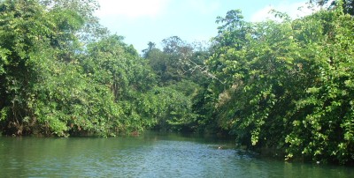
The beautiful Rio Diablo (Devil's River) |
(Chris age 16) Although I
certainly welcomed the end of the days at sea which
brought us to the San Blas, I would have enjoyed the San Blas at any time. They
were beautiful, sandy islands, literally covered in palm trees. In fact, I
wouldn't have minded a bit less greenery so there could be some beaches, but as
it was, if you wanted to walk around the perimeter of most of the islands, you
would get wet.
The really great
part of the San Blas was underwater. Down on the extensive and diverse reefs,
seen through crystal clear water, were fish, corals, octopi, crabs, sharks,
rays, conch, and lobsters. We ate a really good lobster dinner one night, and
watched stingrays leap out of the water (around six feet high) like they thought
they were dolphins! Aside from more insects than I appreciated, it was
absolutely wonderful, especially with the
Harshbargers coming to visit.
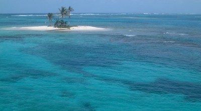
A delightful anchorage in Coco-Banderos
Cays, taken from the spreaders |
The other really
neat thing about the San Blas was going up the Rio Diablo, a river which comes
off the Panamanian mainland and empties at the point where the San Blas islands
meet the Panama coast. The river was fairly shallow, and some parts were tricky
to reach even by dinghy, but it was a lot of fun to go up and explore.
(Jon) Yes,
I could have spent much more than 2 weeks in the San Blas. The clear water
in all the glorious shades of blue, aquamarine, turquoise, royal blue &
umpteen others, the picturesque palm covered islands, the colorful Kunas sailing
around in their dugout canoes, the magnificent snorkeling, & the great
wildlife (over and under the water), all combine to make the San Blas a truly
delightful experience. Getting there after a rather ugly 4-day
crossing, to find long-lost cruising friends made it even more appealing.
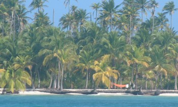
Hammock on an island in the Chichime Cays |
The Kunas
typically live in (rather crowded) villages just offshore from the
mainland. But each village seems to have claim to several of the outer
islands, and they would send various families to those islands to "watch
the coconuts" (actually, to harvest the fallen coconuts to sell to
Columbia). These families would also keep the islands neat and clean,
clearing the underbrush to make a delightfully manicured appearance.
Recently, the Kuna seem to be making money elsewhere, as it seemed to me that
fewer of the islands were being maintained.
To get out to the outer islands, the Kuna make dugout canoes (which apparently
cost about $80). Paddling these canoes is relatively straightforward once you
get your balance, but the Kuna also sail them! They rig a short mast, a
bit of bed-sheet or similar cloth, and a pole (sprit) to keep the far corner
out. How do they keep it from tipping over? They jam in a board that
sticks over the side, & send someone out there to keep the whole thing
upright. Great fun to watch. These guys are really good
sailors. They would often sail miles out to meet us in an effort to sell
us fish, molas, lobsters, or anything else they thought we'd pay for.
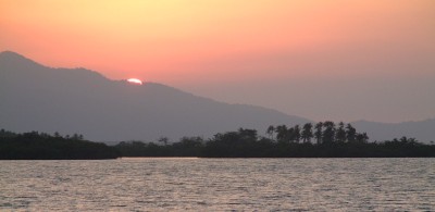
San Blas sunset over the Panamanian mainland |
(Sue) After 15
years, the islands are as lovely as I remembered. This is certainly the one true
remaining paradise of the Caribbean. As I expected, I was enamored of the molas
-- the reverse appliqué fabric art work done, traditionally, by the Kuna women
as front and rear panels on their blouses. I love rich hand stitchery,
embroidery and weaving, and especially love the finest cut molas with their
multi-layers, intricate designs, and joyous colors. The family budget suffered a
bit each time a new canoe arrived with Kuna people (men and women) selling their
artwork. Sharing this beautiful landscape and rich culture with friends from home
was especially wonderful. The San Blas used to be considered a place one
traveled through on the way to the Canal. Now, however, it is a wonderful
cruising ground of its own right. If the Pacific weren't calling, we, too, might
consider spending a few months in these peaceful, friendly islands.
Up | Bonaire | Curacao | Passage | San Blas | Portobelo | Chagres River | Canal Transit | Transit Cruising Info
Leeward Islands | Windward Islands | Venezuela | Southwest Caribbean
| Panama Newsletters
| SW Carib Flora/Fauna
Top Level:
Home |
Destinations |
Cruising Info |
Underwater |
Boat Guests |
Ocelot |
Sue |
Jon |
Amanda |
Chris |
Site Map |
Make a Comment
 |
Lifetime
Commodores
of the
Seven Seas
Cruising
Association |
 |
|
If our information is useful,
you can help by making a donation
|
Copyright © 2000‑ Contact:
Jon and Sue Hacking -- HackingFamily.com, svOcelot.com.
All rights reserved.


