
Back to previous page
Galapagos Map
French Polynesia Passage
Ua Pou
Nuku Hiva
Tuamotu Map
Tuamotu Passage Letters
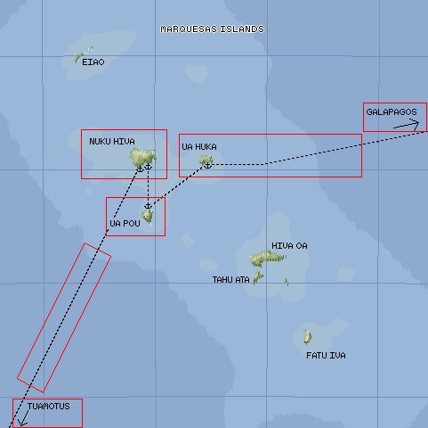
Click on the map (or use the links above) to go to that area.
We arrived in the Marquesas from the east (right side of the map). We only stayed one night in Ua Huka before continuing on to Hakahau Bay on Ua Pou. After a week, we sailed to Taiohae Bay and Daniel's Bay on Nuku Hiva before sailing for the Tuamotus.
Map Scale:
Blue grid lines: 60 miles ( 1 deg)
Ua Huka-Ua Pou: 40 miles (66 km)
Nuku Hiva-Ua Pou: 27 miles (44 km)
Top Level: Home | Destinations | Cruising Info | Underwater | Boat Guests | Ocelot | Sue | Jon | Amanda | Chris | Site Map | Make a Comment
|
If our information is useful, you can help by making a donation |
Copyright © 2000‑ Contact: Jon and Sue Hacking -- HackingFamily.com, svOcelot.com. All rights reserved.